|
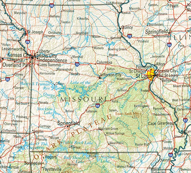
Missouri Reference Map: Shaded relief map with state boundaries, forest cover, place names, major highways. Portion of "The National Atlas of the United States of America. General Reference", compiled by U.S. Geological Survey 2001 Missouri State Government: Official on-line resource to Missouri government agencies and services Missouri State Parks and Historic Sites: Department of Natural Resources, Information concerning state parks and state historic sites in Missouri. Lists information on 80 Missouri state parks. Sorted by region St. Louis County: Useful information and services from St. Louis County government and other agencies |
|
Published by World Readable